The United States hasn’t experienced a hurricane yet this year.
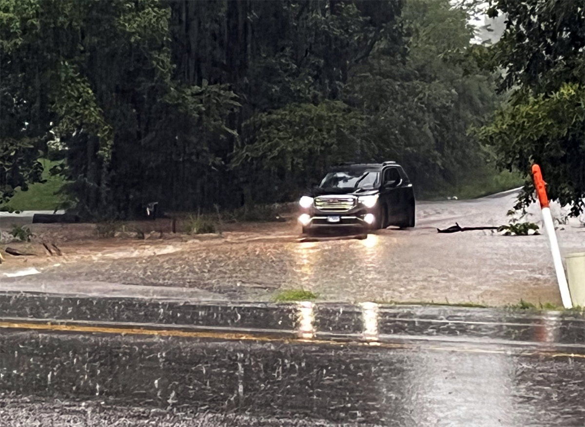
Instead, we’ve had five 1,000-year rain events over a 28-day period. Although we may fear tornadoes, tropical storms or hurricanes, each year floods kill more people than tornadoes, hurricanes or lightning (italics in the original). Floods account for two-thirds of the cost of natural disasters in the United States.
Late August, however, has experienced its share of catastrophic hurricanes:
- Five years ago, Hurricane Harvey slammed into Texas near Port Aransas on 26 August 2017. Category 4. Estimated damage: $125 billion (2017 USD)
- Eleven years ago, Hurricane Irene made landfall near Cape Lookout, North Carolina, on 27 August 2011. Category 1. (Deceptive, that number.) Estimated damage: $14.2 billion (2011 USD)
- And 30 years ago, Hurricane Andrew pummeled Florida (landfall, Homestead) on 24 August 1992. Category 5. One of only four to make landfall as a Category 5 since 1900 (1935, Florida Keys Labor Day storm; 1969, Hurricane Camille; 2018, Hurricane Michael). Estimated damage: $27.3 billion (1992 USD)
Here’s the estimated financial impact of these three hurricanes in 2022 dollars:
- $19,000,000,000 : Irene (2011)
- $57,400,000,000 : Andrew (1992)
- $151,000,000,000 : Harvey (2017)
About those 1-in-1,000 year storms
A ‘1,000-year rain event‘ is a flood so severe that it has only a 0.1 percent probability of happening in any given year.
One of the challenges facing forecasters, emergency planners and insurance companies is that flood zone maps are woefully out of date. For example, loss of soil permeability due to pavement, concrete and buildings affects flood risk.
In addition, the maps are based on rainfall probabilities. Statistical modeling used to generate probabilities in existing maps don’t account for increased extremes.
Current government maps indicate that 8.7 million properties are susceptible to a 100-year flood (1 percent chance in any given year). New data suggest 14.6 million properties are at risk, a 68 percent increase.
Michael Mann, climate scientist from Penn State University, explained the challenge in 2017. A storm surge in New York that had a 1-in-500 probability in pre-industrial times is now 1-in-25. “It could become a once-per-five-year event toward the middle of the century. Precipitation extremes follow a similar trend.”
“We are going to have to change the labeling because these are not one-in-1,000-years events any more,” said Andreas Prein, an expert in climate extremes at the National Center for Atmospheric Research. “It’s shocking to see all of this flood damage but it follows a pattern. These rare events are becoming more and more common and our infrastructure is just not keeping up.”
Washington Post meteorologist Matthew Cappucci also explains how droughts can exacerbate flood damage from heavy rains.
[Droughts] kill plants and leave the ground bare, reducing soil absorption. They also harden top soils, which makes it easier for water to run off. The extremely dry ground, combined with the rapid rainfall, can trigger widespread flooding.
We’re having more droughts, too.
The day before the flood, Dallas-Fort Worth “had been facing one of its worst droughts on record.”
About half of the country has undergone at least a moderate drought this summer. Parts of the West, the Midwest and Texas have experienced exceptional and historic drought conditions.
Here are those five 1-in-1,000 year events (26 July – 22 August).
- 21-22 August: parts of the Dallas-Fort Worth, Texas, experienced torrential rain of 10 to 16 inches. It was the wettest day recorded in August at the DFW airport and second wettest in a 24-hour period. The wettest hour in 69 years of hourly data at DFW Airport occurred between 1 and 2 AM Monday; 3.01 inches of rain fell. This was “more rain than DFW had in any entire month this year, from January through July” (emphasis in the original).
- 05 August: Death Valley, California, got 1.46 inches of rain in a month that has an average rainfall of 0.11 inches. Flash floods stranded 1,000 people; the National Park Service closed all park roads.
- 01-02 August: In a 12-hour period, thunderstorms dumped 8-13 inches of rain in eastern Illinois near Effingham.
- 26-30 July: Thunderstorms generated rainfall rates in excess of 4 inches per hour. The North Fork of the Kentucky River at Whitesburg rose 18 feet in 10 hours; it’s normally only 1-2 feet deep. This flood exceeded the previous record, set in 1957, by at least six feet (the gauge failed). NWS reports that 14-16″ of rain fell during this 5-day period. At least 39 people died.
- 26 July: In St. Louis, Missouri, 7.87 inches of rain fell in six hours (at times, 2 inches per hour). It was the wettest day on record for St. Louis, with a total of 8.64 inches. The prior record, 5.59 inches, was set on 16 May 1995; records date to 1931. More than of 11 inches of rain fell in surrounding areas. Two fatalities were reported.

The 2022 hurricane season
At this point in the August-October season, NOAA has forecast 14-20 named storms; 6-10 that become hurricanes; and 3-5 that become major hurricanes (Category 3-5).
We have experienced only three named storms (Alex, Bonnie, and Colin) this year. Each was short-lived and failed to reach hurricane strength.
Hurricane season runs June through November. September is the historical peak month.
Excerpt from This August, it’s 1-in-1,000 rain events (instead of hurricanes) at WiredPen
Known for gnawing at complex questions like a terrier with a bone. Digital evangelist, writer, teacher. Transplanted Southerner; teach newbies to ride motorcycles. @kegill (Twitter and Mastodon.social); wiredpen.com


