This is a developing news story.
Until recently, Iceland has averaged a volcanic eruption a couple of times each decade. Three volcanos have erupted since March 2021. One was this past July. Signs suggest another eruption is imminent.
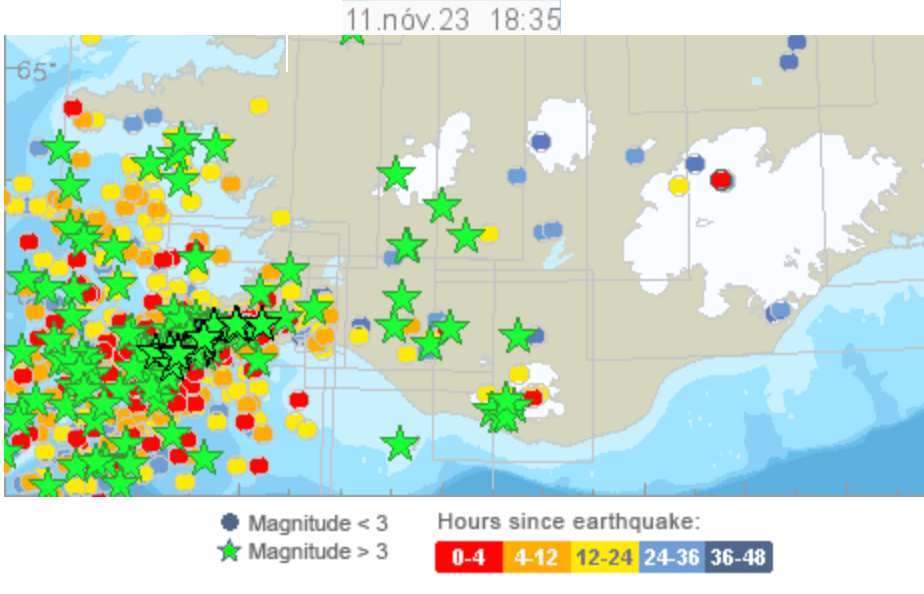
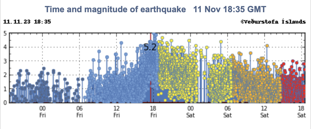
The Iceland Met Office reported Friday at 12:30 pm local time that an earthquake had occured on average every minute for the prior 24 hours on Iceland’s southwestern Reykjanes peninsula.
Update: From midnight to noon Saturday, local time, the region where the magma intrusion is occurring experienced about 800 earthquakes (slightly more than 1 per minute). Most have occurred near Grindavík, where officials estimate the southwest end of the magmatic dyke is located.
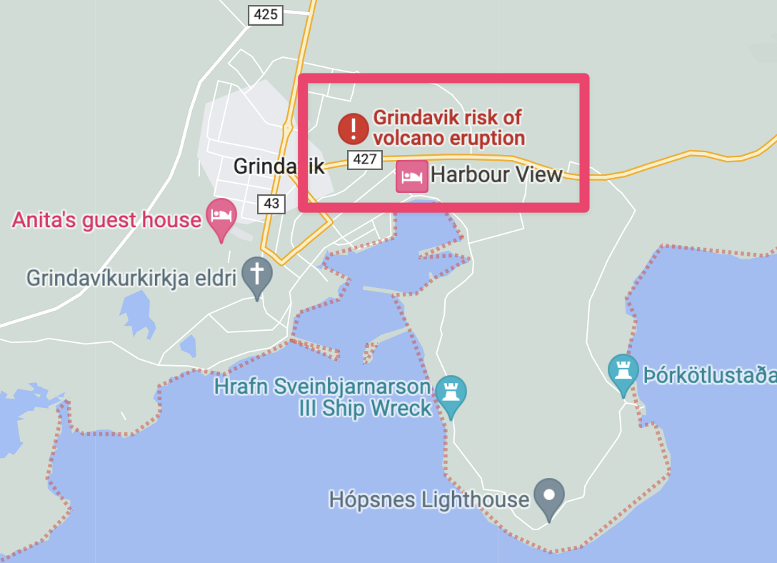
Google Maps has a volcano eruption warning:
From Reuters (November 11, 2023 7:29 PM UTC)
A tunnel of magma, or molten rock, that extends northeast across Grindavik and some 10 km further inland, was estimated late on Saturday at a depth of less than 800 metres, compared with 1,500 m earlier in the day, [Iceland’s Civil Protection Agency] said.
The Blue Lagoon, a geothermal spa southwest of Reykjavík, closed Thursday due to seismic activity.
Iceland’s National Police Commissioner has declared a state of emergency. Shortly before midnight Friday (local time), the Department of Civil Protection directed Grindavik citizens to evacuate due to the risk of volcanic activity as evidenced by the “intense earthquake swarm.” Authorities believe “magma intrusion has extended beneath Grindavík.”
At this stage, it is not possible to determine exactly whether and where magma might reach the surface. There are indications that a considerable amount of magma is moving in an area extending from Sundhnjúkagígum in the north towards Grindavík. The amount of magma involved is significantly more than what was observed in the largest magma intrusions associated with the eruptions at Fagradalsfjall (emphasis added).
Afraid the Icelandic place names are not any easier in this volcanic episode. Sundhnúksgígar*, a row of ancient eruptive craters, is where the dyke lies now #Grindavik
*It says Sundhnúkagígar on the pic, but that's grammatically incorrect
Pic from https://t.co/j9jDjWTZXx pic.twitter.com/7K85sfk2yD— Dr. Evgenia Ilyinskaya (@EIlyinskaya) November 11, 2023
?? Morning. Some Iceland eruption updates:
– The magma instrusion is along a line that stretches from some old volcanic craters to the NE of Grindavík (preexisting zone of crustal weakness) through the town and south into the sea a bit.
— Dr Robin George Andrews ??? (@SquigglyVolcano) November 11, 2023
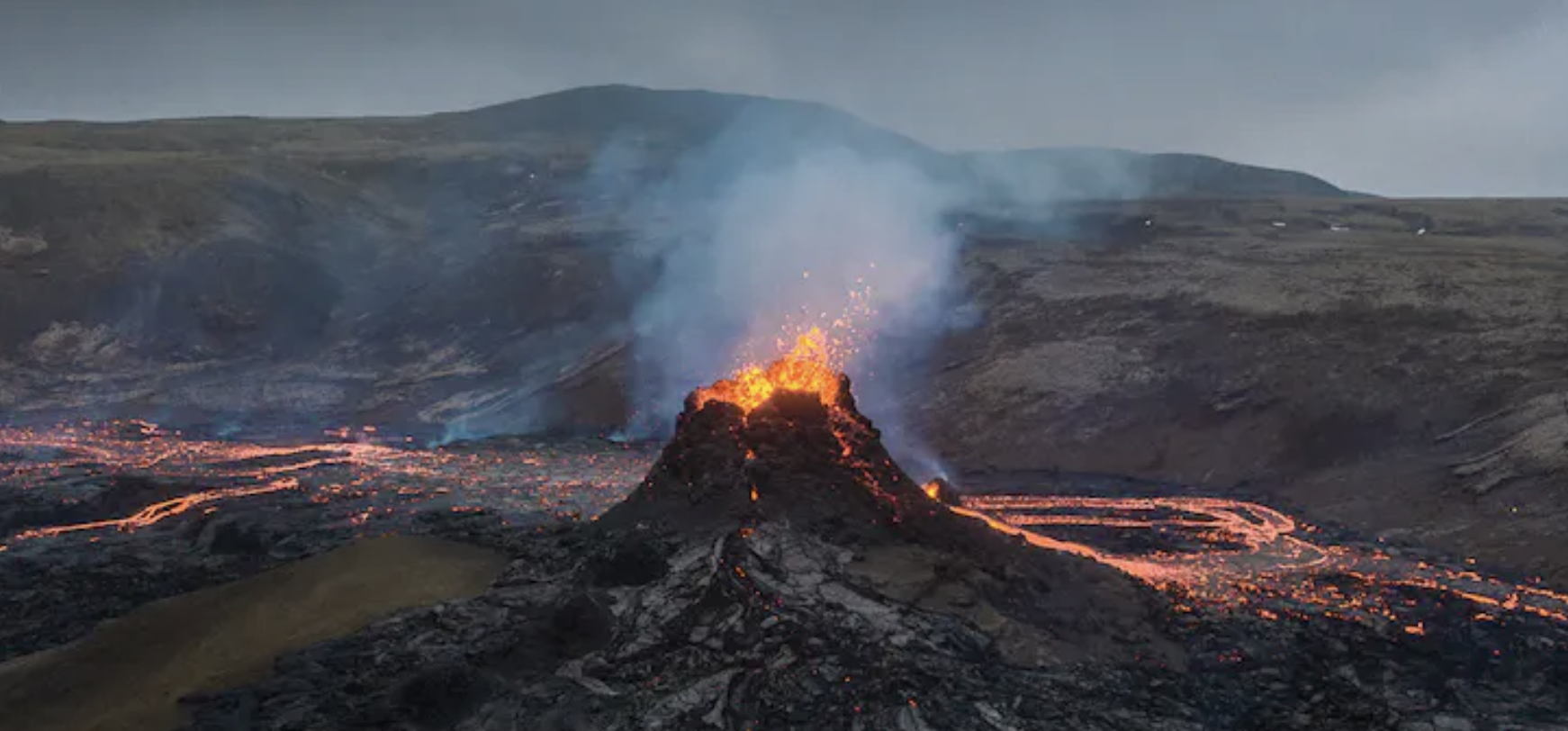
The Fagradalsfjall volcano erupted on March 19, 2021; it continued for six months.
There are three new webcams on the Reykjanes Peninsula. Iceland’s national broadcaster has a live blog and Twitter account.
Iceland sits atop the Mid-Atlantic Ridge, which separates the Eurasian and North American tectonic plates. That helps explain 33 active volcanic systems.
The road between Grindavik and Reykjanesbraut has been closed by the police due to damage. A large crack has formed. #Reykjanes #eruption pic.twitter.com/dyBl2AS5Ng
— Gisli Olafsson (@gislio) November 10, 2023
Talk to me: Facebook | Mastodon | Twitter
Featured image: screen cap.
Known for gnawing at complex questions like a terrier with a bone. Digital evangelist, writer, teacher. Transplanted Southerner; teach newbies to ride motorcycles. @kegill (Twitter and Mastodon.social); wiredpen.com


